Accotink Bay, VA Marine Weather | Pinewater
Accotink Bay, VA
Water temp
––°
F
--
Air temp
––°
F
L:--
H:--
Feels like --°
Wind
--
––
MPH
--
--
––––
––––
––––
––––
––––
––––
Next Tide Predictions
Today
High
--:--
-.-- ft
Low
--:--
-.-- ft
-------
High
--:--
Explore all
Tide station
Nearby
-.-- ft
Low
--:--
-.-- ft
High
--:--
-.-- ft
Low
--:--
-.-- ft
-------
High
--:--
-.-- ft
Low
--:--
-.-- ft
High
--:--
-.-- ft
Low
--:--
-.-- ft
·
·
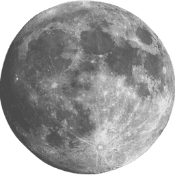
Waning Crescent
Next full
moon
: 17 days
Moonrise: 5:04 AM
Water level
4.38
ft
above MLLW
?
+6
+4
+2
0
-2
+4.38
Rising tide
High
tide
in 3hr 3min
2.61 ft · 6:58 am
Air temp
56°
F
L:54
H:80
Feels like 54°
Wind
S
5
MPH
Light breeze
12 mph gusts
1 Active Notice
Small Craft Advisory
NWS Baltimore MD/Washington DC
Thu 6:00 AM
→
Thu 6:00 PM EDT
Thu 6:00 AM → Thu 6:00 PM EDT
WHAT
West winds 10 to 15 kt with gusts up to 20 kt expected.
WHERE
Chesapeake Bay north of Pooles Island MD, Tidal Potomac from Key Bridge to Indian Head MD and Patapsco River including Baltimore Harbor.
WHEN
From 6 AM this morning to 6 PM EDT this evening.
IMPACTS
Conditions will be hazardous to small craft.
Recommendations
Inexperienced mariners, especially those operating smaller vessels, should avoid navigating in hazardous conditions.
Wave Height
--
No Data
Humidity
83%
51° dew point
Comfortable
UV Index
0
Low
Air Pressure
1011mb
Normal
Visibility
9.8 mi
Clear
Next Tide Predictions
Today
High
6:58 am
2.61 ft
Low
12:56 pm
0.33 ft
High
7:26 pm
2.72 ft
Friday
Low
1:21 am
0.27 ft
High
7:49 am
2.65 ft
Low
1:42 pm
0.27 ft
High
8:12 pm
2.80 ft
Saturday
Low
2:11 am
0.22 ft
High
8:35 am
2.65 ft
Low
2:24 pm
0.25 ft
High
8:55 pm
2.85 ft
Sunday
Low
2:57 am
0.23 ft
High
9:18 am
2.62 ft
Low
3:04 pm
0.29 ft
High
9:36 pm
2.85 ft
Monday
Low
3:42 am
0.30 ft
High
10:01 am
2.54 ft
Low
3:41 pm
0.37 ft
High
10:15 pm
2.81 ft
Tuesday
Low
4:26 am
0.40 ft
High
10:43 am
2.44 ft
Low
4:16 pm
0.46 ft
High
10:55 pm
2.75 ft
Wednesday
Low
5:10 am
0.50 ft
High
11:27 am
2.33 ft
Low
4:52 pm
0.55 ft
High
11:35 pm
2.68 ft
How this works
NOAA Predictions
·
Marshall Hall, Md. tide station (3.04 mi)
How this works
Note: The interval shown is High/Low only. The solid orange line is a curve fit between high and low values and approximates the segments between.
Satellite Observations
·
~5mi resolution
Times in Eastern Daylight Time
Water temp
No data
F