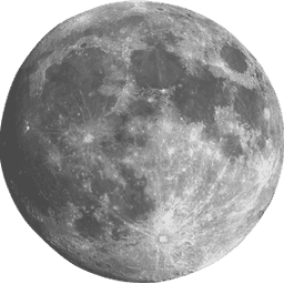
Waning Crescent
Next full
moon
: 17 days
Moonrise: 5:22 AM
Water level
1.80
ft
above MLLW
?
+6
+4
+2
0
-2
+1.80
Air temp
76°
F
L:76
H:85
Feels like 85°
Wind
W
3
MPH
Light air
3 mph gusts
Rising tide
High
tide
in 4hr 37min
2.72 ft · 8:29 am
1 Active Notice
Coastal Flood Statement
NWS Miami FL
Thu 1:36 AM
→
Fri 10:00 PM EDT
Thu 1:36 AM → Fri 10:00 PM EDT
WHAT
Isolated minor coastal flooding.
WHERE
Coastal Palm Beach County, Coastal Broward County, Coastal Miami Dade County and Far South Miami-Dade County.
WHEN
Through Friday evening.
IMPACTS
Some water on low lying roads and property.
Recommendations
Do not drive through flooded roadways.
Next Tide Predictions
Today
High
8:29 am
2.72 ft
Low
2:57 pm
0.39 ft
High
8:48 pm
2.68 ft
Friday
Low
3:17 am
0.22 ft
High
9:17 am
2.80 ft
Low
3:43 pm
0.39 ft
High
9:30 pm
2.69 ft
Saturday
Low
4:00 am
0.16 ft
High
10:01 am
2.83 ft
Low
4:25 pm
0.42 ft
High
10:10 pm
2.67 ft
Sunday
Low
4:40 am
0.16 ft
High
10:42 am
2.81 ft
Low
5:06 pm
0.49 ft
High
10:48 pm
2.61 ft
Monday
Low
5:20 am
0.21 ft
High
11:21 am
2.74 ft
Low
5:46 pm
0.58 ft
High
11:25 pm
2.53 ft
Tuesday
Low
5:59 am
0.30 ft
High
12:00 pm
2.63 ft
Low
6:25 pm
0.70 ft
Wednesday
High
12:03 am
2.43 ft
Low
6:38 am
0.42 ft
High
12:40 pm
2.51 ft
Low
7:05 pm
0.82 ft
How this works
NOAA Predictions
·
Bakers Haulover Inlet (inside) tide station (1.15 mi)
How this works
Note: The interval shown is High/Low only. The solid orange line is a curve fit between high and low values and approximates the segments between.
Satellite Observations
·
~5mi resolution
Times in Eastern Daylight Time
Wave Height
1.4 ft
Slight
Humidity
92%
74° dew point
Very humid
UV Index
0
Low
Air Pressure
1010mb
Normal
Visibility
8.1 mi
Clear
Water temp
85°
F
Warm